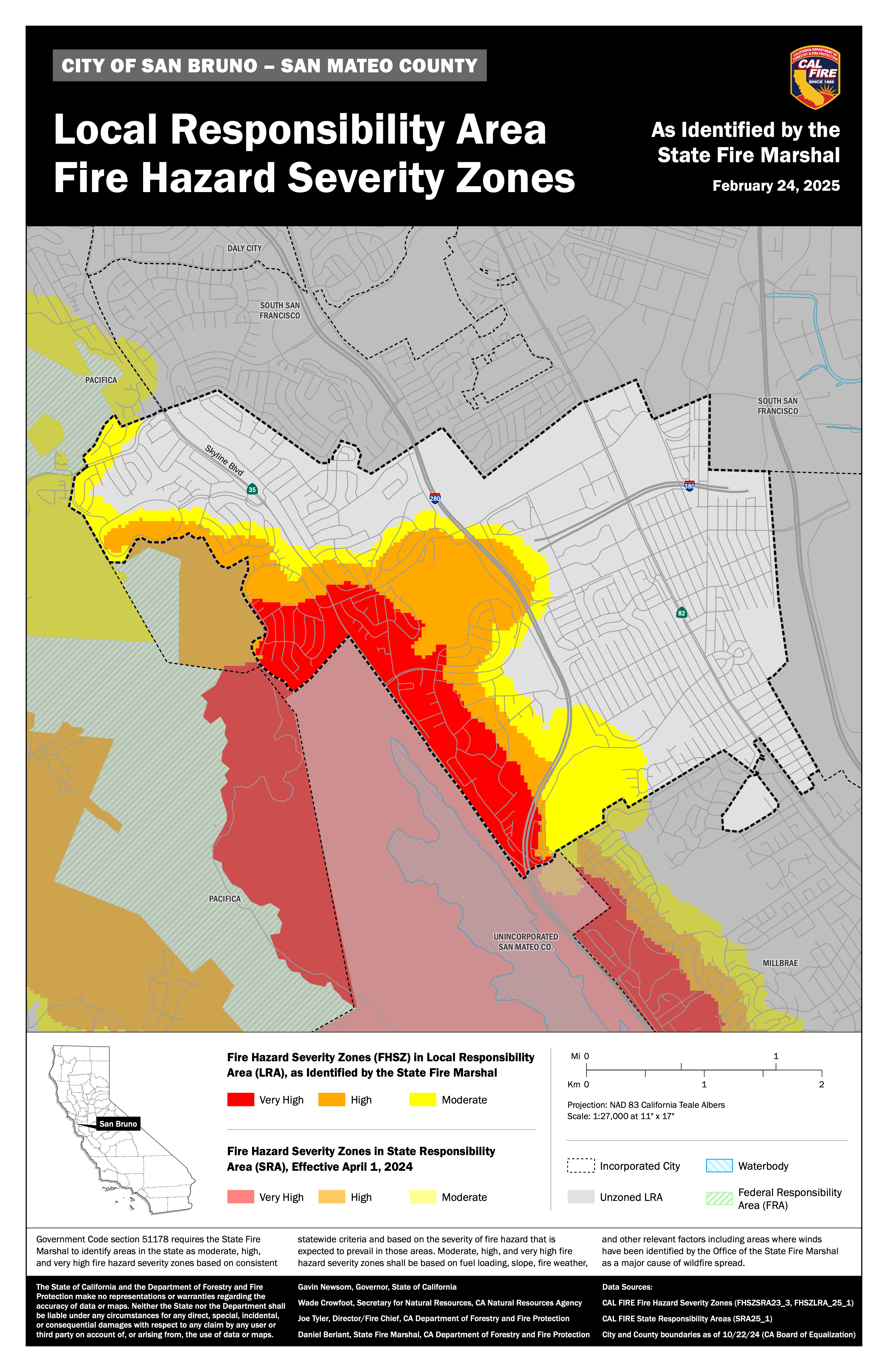
Fire Hazard Severity Zones (FHSZ) are new to San Bruno
On July 10, 2025, the City of San Bruno adopted the State Fire Marshal's updated Fire Hazard Severity Zone (FHSZ) maps, as required by State law (California Government Code 51179). The maps identify new areas of San Bruno as Moderate, High, or Very High Fire Hazard Severity Zones.
While these new FHSZs reflect the latest science on vegetation, topography, weather, and wildfire behavior, these designations do not mean every property is in immediate danger. FHSZ mapping does signal where wildfire can spread more quickly and intensely, and where extra home hardening and fire prevention measures are now required by state law and local ordinance to increase wildfire resilience.
Who does this directly affect?
- Property owners, developers, design professionals, and contractors whose parcels and/or projects fall in a mapped Moderate, High, or Very High FHSZ.
- Real estate sellers and agents involved in transactions for properties in those zones are required to comply with mandatory wildfire hazard disclosure requirements.
What changes for these properties?
- New construction and qualifying alterations in the designated zones must comply with Wildland-Urban Interface (WUI) / Part 7 of Title 24-type building standards (ignition-resistant materials, ember-resistant vents, etc.).
- 100‑foot defensible space requirements and upcoming “Zone 0” type regulations (0–5 feet noncombustible zone in Very High areas) will apply.
- Sellers must disclose the FHSZ status of the property in real estate transactions.
How do I know if my property is in a Fire Hazard Severity Zone (FHSZ)?
- Use the City of San Bruno GIS page and select the natural hazard layer, then the wildland hazard areas.
- Enter your address in the statewide FHSZ viewer.